
Esri EADA10 - ArcGIS Desktop Associate
An ArcGIS user is collecting climate data, and wants to create a graph showing wind direction at different weather stations. Which type of graph should be used to display this data?
Which ArcGIS Desktop extension can be used to create a map with advanced label placement options?
An ArcGIS user is exporting a feature class to an existing feature data set using the Export Data option from the layer context menu in ArcMap. The feature class coordinate system differs from the feature data set coordinate System.
What will be the coordinate system of the exported output?
An ArcGIS user has two feature classes. One is spatially inaccurate but contains accurate tabular data, the other is spatially accurate but contains inaccurate tabular data. The ArcGIS user needs a single feature class that is spatially and tabularly accurate
Which tool should the ArcGIS user employ to accomplish this?
When starting an edit session in ArcMap the ArcGIS user is unable to locate the geodatabase feature class in the Start Editing list.
Why does the layer fail to show up in the Start Editing list?
An ArcGIS user is analyzing an earthquake dataset to investigate the relationship between magnitude and duration of incidents. The user displays magnitude on an x-axis and duration on a y-axis.
Which type of graph is the user employing?
A client requests a map of a project area and wants to view the data in ArcReader. What is a valid way for the ArcGIS user to share the project area with them?
An ArcGIS user is editing a feature class containing parcel data. One of the fields within the table stores the zoning information for each parcel using a coded value domain.
How does the user enter this data into the Attributes window to update the zoning information for a parcel?
Which geodatabase element is designed for modeling the flow of a resource such as water electricity, or natural gas from its source to a consumer?
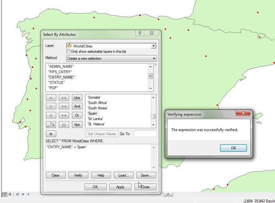
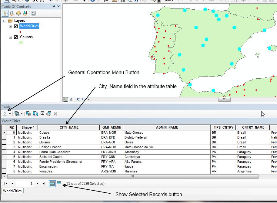
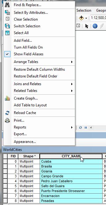
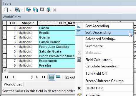
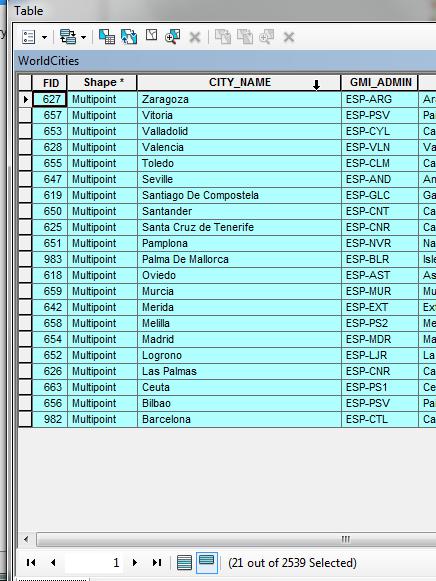
An ArcGIS user wants to display only values for the selected features in an attribute table in reverse alphabetical order (z to A) using the values CityName field.
Which method will give the desired results?