

Esri EADP19-001 - ArcGIS Desktop Professional 19-001
An ArcGlS user decides to use labels in a map document because the annotation appears pixelated as the user zooms from the reference scale
What Is a potential effect of this decision?
Upon opening a model In ModelBuilder. one 01 the tools has a repair icon next to it. How can the model be repaired?
Refer to the exhibit.
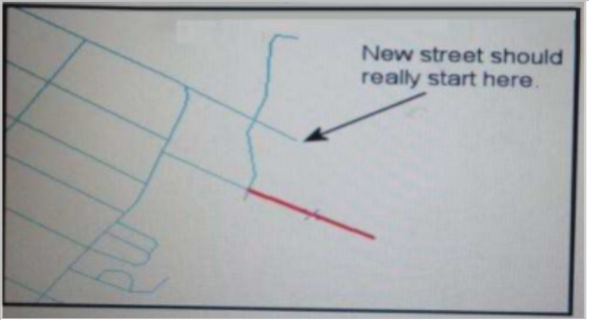
An ArcGIS user added a new street (shown in the exhibit) to a streets feature class within an edit session.
The new street seems to have snapped to an existing street but upon zooming in the ArcGIS user notices that the street is connected to the wrong street.
What is the most likely reason for this error?
An ArcGlS user has high-resolution single-band data and another raster datasetthat is multiband with lower resolution. Which process is used to convert the single-band data to multi-band, while retaining its resolution?
An ArcGlS user receives parcel data from the regional government, which is supposed to line up with parcels in the data maintained by the local government. The user is tasked with reconciling the discrepancies between the local and regional data.
In which situation are the parcel boundaries within the local data more likely to be accurate than the regional data?
A representation layer has been defined using the option to save changes to the geometry of the supporting feature. If the geometry of the feature is modified using the tools from the Representation toolbar, what will be modified?
An ArcGIS user is creating a script tool to automate a common workflow.
Which tool property ensures that the tool only recognizes intended feature data sources?